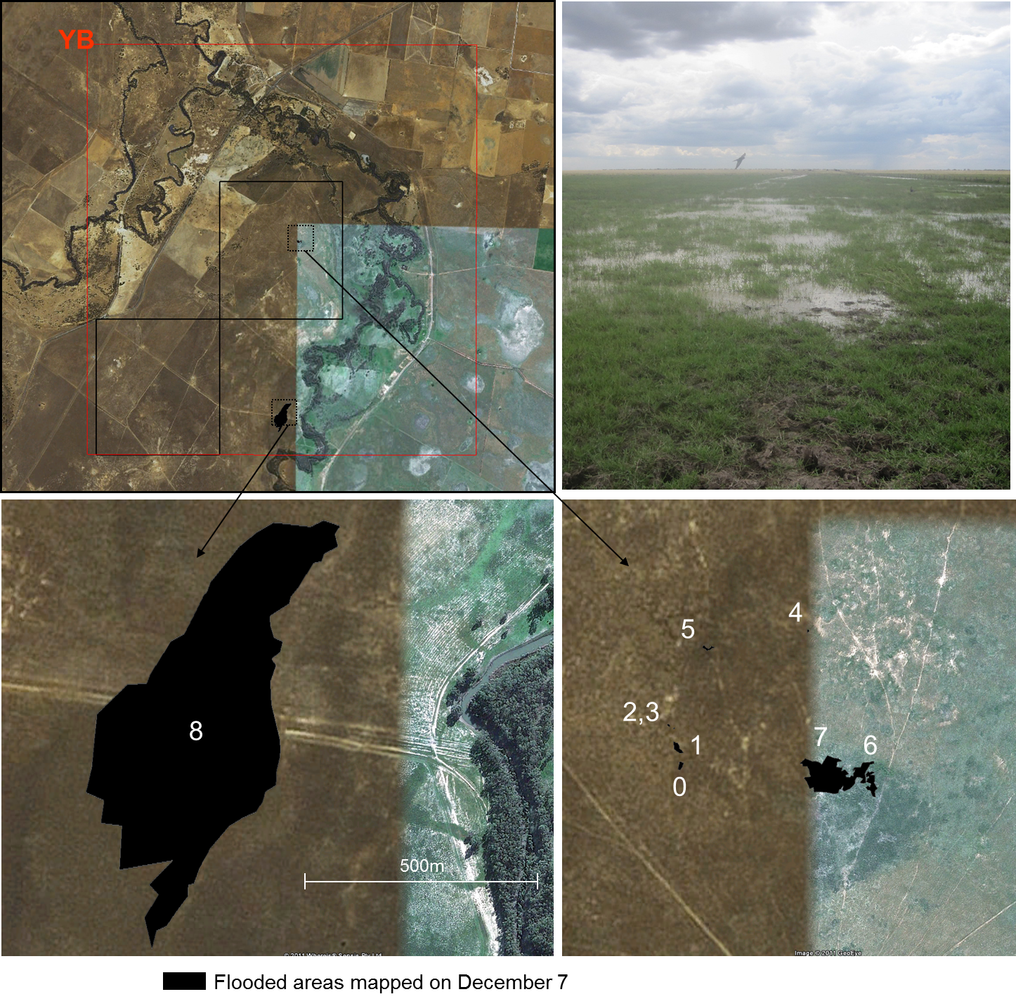
Flooded Area Mapping
The intense rainfall prior to the SMAPEx-2 campaign caused extensive flooding in the study area, with access to several of the SMAPEx sampling areas made difficult by standing water throughout the experiment. A limited mapping of flooded areas was performed by a team of two people on Tuesday, December 7 in the target YB area, around 146°18.625’E and approximately between 34°57.917’S and 35°0.584’S. The boundaries of 9 areas presenting surface water and ranging in size from 10 m2– 0.2 km2 were mapped using GPS in order to provide validation data for radar estimates of standing water.
For each area, the GPS coordinates of the boundaries were recorded, together with ancillary observations on the above water vegetation type, height and fraction cover and water depth. Vegetation height and water depth were estimated by random sampling at several locations using a metered stick. Vegetation cover fraction was estimated visually. It should be noted that these measurements should be treated as rough estimates. All data collected can be downloaded from the Download Centre.
Map of flooded area in YB
Surface Area (approx)
Vegetation type
Water depth (cm)
Above water vegetation height (cm)
Above water vegetation fraction cover (%)
14ha
short green grass
~50 (not measured)
10
20
0.5ha
native grass
5-10
50
40
0.1ha
native grass
15-20
40
40
400m2
native grass
5
30
10
220m2
native grass
3
20
5
100m2
native grass
5-7
35
40
10m2
native grass
5
15
5
10m2
native grass
7
40
20
3m2
native grass
5
20
10